Piano Noce, SP119 · Out and back
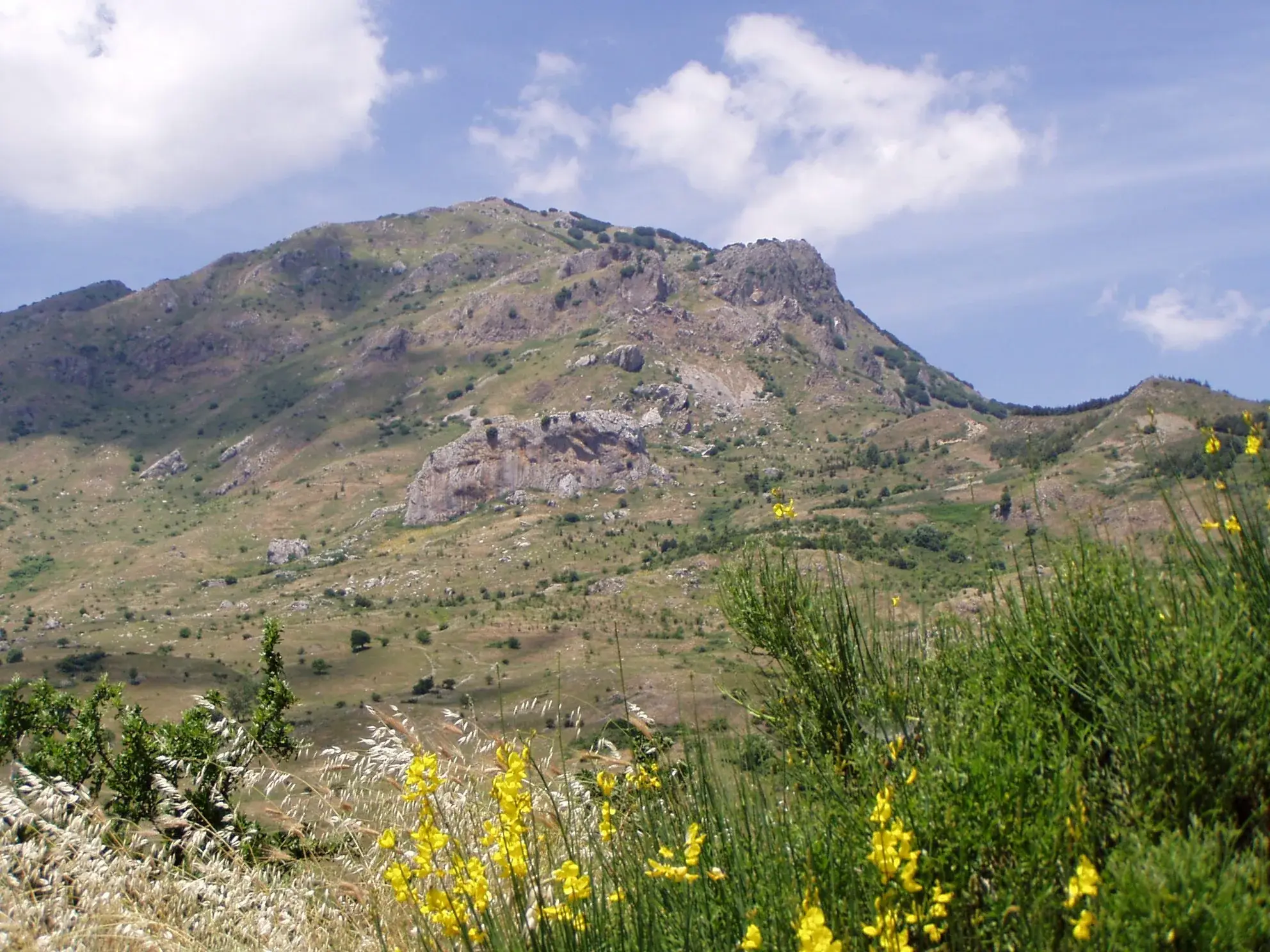
Monte San Salvatore, the second peak of the Madonie
Monte San Salvatore, 1,912 m: the climbs from Piano Noce, Pomieri and Petralia Sottana, Park times, best season, the Madonna dell'Alto sanctuary and tips.
Along the way
- Summit at 1,912 metres, second in the Park after Carbonara
- Views of the two Petralias, the Nebrodi and Etna
- Beech woods of Punta dell'Inferno and Portella di Mele
- Madonna dell'Alto sanctuary, among the highest in Italy
- Three routes up, from the west, north and south
Monte San Salvatore, 1,912 metres, is the second peak of the Madonie Park (Parco delle Madonie) after the Pizzo Carbonara plateau. You can climb it from three sides: from Piano Noce on the SP119, from the Pomieri area or from Petralia Sottana. For the hike the Park gives about 10 km, 750 metres of climbing and 6 hours of walking without stops. The right season runs from late May to October.
It is a full mountain day, with no technical passages but plenty of uphill.
Why climb San Salvatore
For the view over the south side of the Madonie, the one you cannot see from Piano Battaglia. From the summit you look at the two Petralias, the other Madonie villages, the Nebrodi and, on clear days, Etna.
And because it is the pilgrims’ mountain. Just below the summit stands the Madonna dell’Alto sanctuary, on Monte Alto, which the Park lists among the highest Marian sanctuaries in Italy. It holds a marble statue of the Madonna that the Park attributes to Gagini.
The three routes up
The Park describes three hiking approaches, with paths that are mostly visible but signposting that comes and goes.
From the west, from Piano Noce. On the road between Polizzi Generosa and Portella Colla a dirt track skirts the Vallone Madonna degli Angeli and climbs to Piano Iola, the west summit. A more scenic path crosses the valley and climbs the north side of Monte Scalone. It is the route closest to the Madonie firs.
From the north, from the Pomieri area. A dirt road climbs to Portella di Mele and crosses the beech wood of Punta dell’Inferno to Cozzo del Filatore, then reaches the east summit. This stretch also carries the Park’s red and white waymarks for the Sentiero della Pace.
From the south, from Petralia Sottana. You follow the path that runs from the Ponte di San Brancato, near the hospital, to the Madonna dell’Alto sanctuary. It is the longest route, which we describe on the Sentiero della Pace page.
Download a track before you go: on the ridges the waymarking is not continuous.
Who it is for
The Park grades the climb E, for fit hikers. The difficulties are length and ascent. On the summit, according to the Cefalù Madonie tourist district, you walk on natural ground and easy rocks.
If you have never walked 6 hours in the mountains, start with a shorter hike such as the Abies nebrodensis trail.
When to go
Spring and autumn are the best periods, with mild temperatures and beech woods that change colour in October. In summer people climb happily, but on sirocco days the steep slopes wear you out, the Park warns. Up high the wind is strong even in August.
The sanctuary comes alive for the feast of the Madonna dell’Alto, on the first Sunday of July and on 15 August, according to the Park.
In winter the summit is often snowbound and the climb turns into winter mountaineering. Check the weather at Portella Colla and in Petralia Sottana before you go.
How to get there
For Piano Noce you drive up from Polizzi Generosa on the SP119, closed after a landslide near the Portella Colla junction since February 2026 and, at the time of writing, not reopened: while it stays closed use the routes from Pomieri or Petralia Sottana, and check the Madonie roads page. For the southern route you set off on foot straight from Petralia Sottana.
Where to sleep and eat
Petralia Sottana suits the southern route and Pomieri: see where to stay in Petralia Sottana and where to eat in Petralia Sottana. For the western route the base is Polizzi Generosa, with accommodation in where to stay in Polizzi Generosa.
Safety tips
- Carry water for the whole day. The only reliable fountain mentioned by the sources is the one below the sanctuary.
- Always have a windproof jacket and a warm layer: at almost 2,000 metres the weather changes fast.
- In fog, go back the way you came.
- In autumn the Park publishes “danger zone” notices for wildlife control with firearms, including at Portella Colla: check the news on the Park website before you go.
Frequently asked questions
- How high is Monte San Salvatore?
- Monte San Salvatore is 1,912 metres high according to the Madonie Park authority, which lists it as the second peak in the Park after the Pizzo Carbonara plateau. It stands between Polizzi Generosa and Petralia Sottana, above the Madonna dell'Alto sanctuary.
- How long does the Monte San Salvatore hike take?
- For the hike the Park gives about 10 km, about 750 metres of ascent and descent and 6 hours of walking excluding stops, on footpaths and forest roads. It is a full day: start early and bring lunch.
- Is Monte San Salvatore difficult?
- The Park grades it E, a hiking route, but for fit walkers. There are no technical passages: the effort comes from the length and the climb. On the summit you walk on natural ground and easy rocks, where a little balance helps.
- Where do you start for Monte San Salvatore?
- The Park describes three approaches. From the west, from Piano Noce on the road between Polizzi Generosa and Portella Colla, via the Vallone Madonna degli Angeli and Piano Iola. From the north, from the Pomieri area via Portella di Mele. From the south, from Petralia Sottana via the Ponte di San Brancato and the Madonna dell'Alto sanctuary.
- Can you do it with children?
- The full climb is long for small children: six hours of walking without stops is a lot. With fit teenagers it works on a cool day. For a shorter family outing choose the Abies nebrodensis trail, which starts in the same area.
- When is the best time to climb Monte San Salvatore?
- From late May to October. Spring and autumn have the most pleasant temperatures and the beech woods change colour in October. In summer avoid sirocco days. In winter the summit is snow-covered and the climb becomes a winter outing for experts.
Sources
- Ente Parco delle Madonie, Escursione a Monte San Salvatore 1912 m
- Ente Parco delle Madonie, Sentiero della Pace
- Distretto turistico Cefalù Madonie Himera, sentiero 587 Sentiero della Pace
- Ente Parco delle Madonie, news e avvisi (zone di controllo della fauna)
- La Sicilia, frana sulla SP119 e chiusura della strada (6 febbraio 2026)
Page updated on 19 October 2026
More trails
You may also like
 Hiking trail
Contrada Quacella, SP119 · Loop
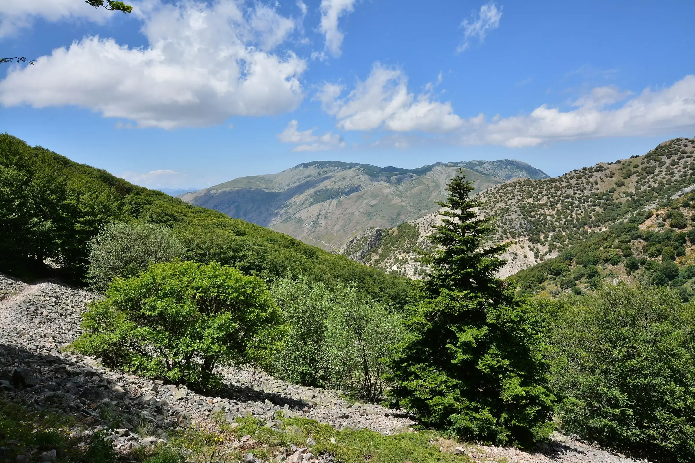
Vallone Madonna degli Angeli and the Abies nebrodensis
 For experienced hikers
Polizzi Generosa · Out and back
Monte Quacella: trails and routes to the summit
 Hiking trail
Piano Battaglia · Loop
Pizzo Carbonara from Piano Battaglia
- Distance
- about 7 km
- Time
- about 2 h 30