1 day · Spring · Summer · Autumn · Winter
Sea and mountains: Cefalù to Piano Battaglia in one day
Sea and mountains in one day from Cefalù: morning at Piano Battaglia, 1,600 metres, afternoon on the beach. A 106 km loop, times, walks, winter version.
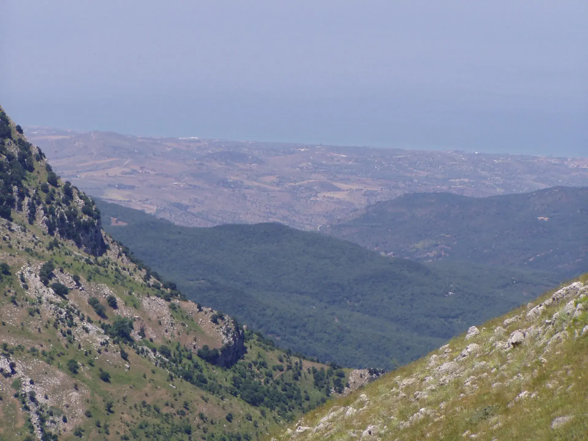
From Cefalù to Piano Battaglia it’s 45 km and about an hour by road: you go from 16 metres above sea level to about 1,600, through holm oaks, beech woods and karst plateaus. So in a single day you can walk in the mountains in the morning and swim in the afternoon. The loop we suggest is about 106 km, with 2 hours 20 minutes of driving, and comes back via Castelbuono.
At a glance
- Start and finish: Cefalù.
- Distance and driving: about 106 km, 2 hours 20 minutes without stops, calculated on OpenStreetMap.
- Height gain by car: from 16 metres to about 1,600.
- Walk: the Pizzo Carbonara loop, about 7 km in 2 hours 30 minutes, or a walk on the plateau.
- Season: May to September for swimming. In winter it becomes snow and sea.
- Timing: leave at 7.30 am, on the beach around 4 pm.
Who is it for?
For people on holiday in Cefalù who want to see the Madonie without losing a beach day. For people who don’t want to drive much: the longest leg takes an hour.
The plan works with teenagers who walk, too: instead of Pizzo Carbonara, a walk at Piano Battaglia is enough. With small children, see the Madonie with children itinerary instead.
Why mountains in the morning and sea in the afternoon?
For practical reasons. Pizzo Carbonara is an exposed trail: walking early means less heat and more daylight ahead. On the plateau fog rises quickly, our trail page warns, and it’s better to be on your way down by midday. On the beach, by contrast, the sun is lower by mid-afternoon.
If you want sunrise by the sea, do it the other way round: an early swim, mountains in the afternoon, dinner in Castelbuono. But up high you risk cloud and fog.
When to do it?
May to September, for water warm enough to swim. June and September are, in our view, the best months: it’s less hot on the trail than in July and August.
In autumn the sea is colder, but around Piano Battaglia the beech woods turn: where and when is in our guide to the beech woods in autumn.
In winter, with snow, the trip becomes a Sicilian classic: a morning in the snow at Piano Battaglia and a walk along the Cefalù seafront at sunset. Check the snow chain or winter tyre rules on our roads page and the state of the lifts in the guide to snow in the Madonie before you go.
The driving route
Distances and times calculated on 19 October 2026 with OSRM on OpenStreetMap data, with no traffic or stops:
| Leg | Roads | km | Driving |
|---|---|---|---|
| Cefalù → Isnello | SP54bis, SP9 | 21 | 35 min |
| Isnello → Piano Zucchi | SP9, SP54 | 14 | 15 min |
| Piano Zucchi → Piano Battaglia | SP54 | 10 | 15 min |
| Piano Battaglia → Castelbuono | SP54, SP9 via Isnello | 37 | 45 min |
| Castelbuono → Cefalù | SS286, SS113 | 24 | 30 min |
| Total | 106 | 2 h 20 |
These are narrow, winding mountain roads: the times in the table are minimums. Landslides and closures happen, especially after rain. Before setting off, check the notices on our roads page.
Morning: from Cefalù to Piano Battaglia
The climb
Leave Cefalù inland on the SP54bis. In 35 minutes you’re in Isnello, home of GAL Hassin, the astronomy park. Don’t stop today: keep it for another time or for a rainy day.
Above Isnello the road climbs to Piano Zucchi, a plateau at about 1,080 metres. Stop for a minute to look at the valley. Then another 10 km on the SP54 to Piano Battaglia. Before you leave, check the Piano Battaglia forecast.
On foot
Piano Battaglia is a karst basin below Monte Mufara. This is the start of the Pizzo Carbonara loop, the highest peak in the Madonie at 1,979 metres. It’s about 7 km in 2 hours 30 minutes, stops excluded, grade E: you need hiking shoes and 2 litres of water each, because there’s none on the trail.
In fog the plateau is hard to read: if visibility drops, turn back. If you don’t feel like it, walk on the plateau and in the nearby woods. The basic rules are in our mountain safety guide.
Lunch
On the plateau there’s the Rifugio Giuliano Marini, with a restaurant: we mention it because it’s the closest to the trail. Otherwise bring a sandwich and eat it at the top.
Afternoon: from Castelbuono to the sea
Drive down towards Piano Zucchi and Isnello and you reach Castelbuono in 45 minutes. Stop for an ice cream or a manna pastry and walk up to the Ventimiglia castle. From April to October the Museo Civico reopens at 3 pm and closes at 6.30 pm, according to the museum’s hours checked on 19 October 2026.
Then 24 km on the SS286 and you’re in Cefalù. The beach is next to the old town: if you have time before sunset, visit the Norman cathedral, part since 2015 of the UNESCO site Arab-Norman Palermo and the Cathedral Churches of Cefalù and Monreale.
If the weather is bad up high
Check the forecast the night before. With fog, strong wind or thunderstorms up high, give up on Pizzo Carbonara. You have 2 alternatives:
- Stay low: Castelbuono with its castle and centre, then Gratteri, which the Balarm website calls the terrace over the Tyrrhenian. From Cefalù to Gratteri is 17 km.
- Go to GAL Hassin in Isnello: the standard visit lasts 2 hours 30 minutes, with planetarium and museum, and is booked on its website.
If it rains on the beach too, climb the Rocca di Cefalù as soon as it stops: it’s an easy path, with views over the cathedral, the harbour and, to the south, the Madonie.
Where to stay and eat
Cefalù is the natural base: places to stay in where to stay in Cefalù and restaurants in where to eat in Cefalù. If you want dinner in the mountains and a late drive back, see where to eat in Castelbuono: it’s 24 km of main road.
Practical tips
- Pack a jacket and a fleece: Piano Battaglia is much cooler than the coast. Compare the Cefalù forecast with the one up high.
- Leave your swimsuit in the car, so you don’t have to go back to the hotel.
- Fill up before the climb.
- For emergencies call 112.
-
Day 1Morning up high, afternoon on the beach
Leave Cefalù early, drive up via Isnello and Piano Zucchi to Piano Battaglia and walk while the air is cool. Come down via Castelbuono and you're on the beach in Cefalù by mid-afternoon. About 106 km and 2 hours 20 minutes of driving in total.
- Village Cefalù Leave around 7.30 am. SP54bis and SP9 towards Isnello.
- Place Piano Zucchi A plateau at about 1,080 metres, 35 km and 50 min from Cefalù. Stop for the view.
- Place Piano Battaglia Another 10 km on the SP54, about 15 min. Arrive around 8.45 am.
- Trail Pizzo Carbonara from Piano Battaglia Loop of about 7 km in 2 h 30, grade E. Or a walk on the plateau.
- Where to stay Rifugio Giuliano Marini Refuge with a restaurant on the plateau, a few steps from the trail.
- Village Castelbuono From Piano Battaglia 37 km via Piano Zucchi and Isnello, about 45 min. Ice cream, castle, a stroll in the centre.
- Place Cefalù beach From Castelbuono 24 km on the SS286, about 30 min. A swim and the sunset.
Frequently asked questions
- Can you do sea and mountains on the same day in Sicily?
- From Cefalù it works well: Piano Battaglia, at about 1,600 metres, is 45 km and an hour's drive from the beach. On a loop of about 106 km you walk up high in the morning and you're by the sea by mid-afternoon.
- How far is Piano Battaglia from Cefalù?
- About 45 km via Isnello and Piano Zucchi, an hour or a little more without stops, according to our OSRM calculation on OpenStreetMap. It's a mountain road, narrow and full of bends.
- In winter, can you ski and then go to the sea?
- When there's snow at Piano Battaglia, a morning on the slopes and an afternoon on the Cefalù seafront are possible. No swimming, but a sunset walk, yes. Check chains, roads and lifts first.
Sources
- Wikipedia, Parco delle Madonie (height of Pizzo Carbonara, karst at Piano Battaglia)
- Wikipedia, Palermo arabo-normanna e le cattedrali di Cefalù e Monreale
- Museo Civico di Castelbuono, hours
- GAL Hassin, visits for the public
- Balarm, Gratteri "terrace over the Tyrrhenian"
- Alte Madonie, Rifugio Marini
- Distances and times: OSRM on OpenStreetMap data, calculated on 19 October 2026
Page updated on 19 October 2026